
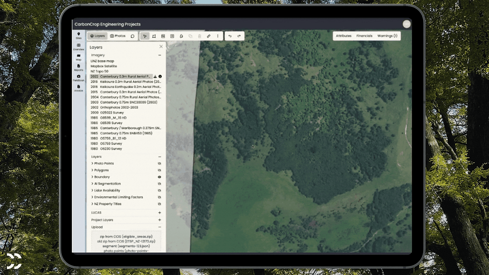
Collecting field evidence for your planting projects or ETS submission? FieldScan photos now show on the map exactly where they were taken.

FieldScan photos on map
Keeping track of 100s of field photos is a pain. CarbonCrop now lets you organise and see photos directly in the platform. Upload photos directly, or use FieldScan to take geotagged photos.

New Features
ETS Submitted

Keep track of your submitted forest areas and avoid possible mistakes. Forest areas can now be marked as “Submitted” to help managing your ETS projects.
Shortcuts for historical imagery
To help map across time, you can now use Q and W to cycle through recently viewed imagery.
Login through the website
You can now access the login page for the CarbonCrop platform from the carboncrop.com website. No more bookmarking to access the page!
Sites list

Stay on top of your new sites with ease. New sites now appear at the top of the site list, instead of the bottom.
Bug Fixes
Crop to boundary
The 'crop to boundary' function is now more reliable.
Panning while using tools
Panning while using the split or reshape tool no longer creates additional vertices.
Comments
Deleting comments now works again.
Error messages improved
When polygons are invalid, the reports now show a better error message.
Our team is consistently working to improve our tech, stay tuned for more updates next month! Missed last month's update? Check it out here
Comments